File:TV Dinnah Map.png
Jump to navigation
Jump to search

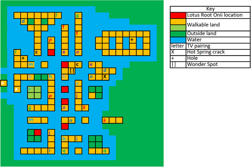
Size of this preview: 800 × 534 pixels. Other resolutions: 320 × 214 pixels | 1,126 × 752 pixels.
Original file (1,126 × 752 pixels, file size: 54 KB, MIME type: image/png)
Summary
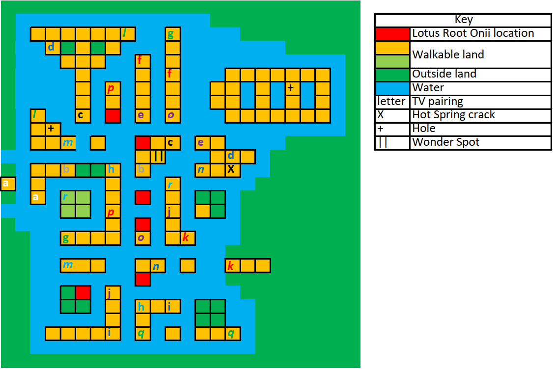
A diagrammatic map with a key showing the connections between TVs on Screw-Loose Isles, and the locations of special objects.
Licensing
This file was uploaded by the photographer or author.
File history
Click on a date/time to view the file as it appeared at that time.
| Date/Time | Thumbnail | Dimensions | User | Comment | |
|---|---|---|---|---|---|
| current | 00:38, 11 May 2024 | | 1,126 × 752 (54 KB) | Pedalwerk (talk | contribs) | == Summary == A diagrammatic map with a key showing the connections between TVs on Screw-Loose Isles, and the locations of special objects. |
You cannot overwrite this file.
File usage
The following page uses this file: